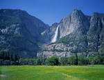
Q. Why would you want to do the Ledge Trail?
A. Because, I'm a guy, and we do things like that.
DAY 3 -
http://www.youtube.com/watch?v=eFYMl_OhiEsThat diagonal green line on the Glacier Pt. cliff
has had me by the ya-ya ever since I found out what
it was, 2 years ago. Abandoned for 60 years ....big
body count...deadliest trail in Yosemite...Last year,
I asked several park employees about it, and they
looked at me like I was wearing a turban. They would
then rattle off a well rehearsed company line about
the dangers of the Ledge, etc. Their warning sunk
in, and I only went up a few hundred feet. This year,
I didn't ask anybody.
On Sept 4, armed with precious little rock climbing/
scrambling experience, I disappeared into the trees
behind the Happy Isles parking lot. Soon, I was on
the Ledge...

With decades of neglect, the Ledge is littered with
shattered rock from hundreds of feet above. I would
soon discover that big rocks are your friend; they
hold weight better than small ones. Signs of previous
human occupation can also be comforting...

Occasional trees/shrubs can be found. This is a hint
at what lies ahead..

To get an idea of the lay of the Ledge, put your left
hand at belt buckle level. Your left arm now takes the
shape of the trail, sloping upward to the turn at the
elbow, and steeply upward from their. Along the route
is the glorious scenery from the Valley below...


Of course, I had my eyes shut the whole time.
The Ledge Trail offers subtle danger. You won't likely
become a pile of human goulash after a 1000 foot
free fall. Instead, the unstability of the surface could
lead to a slide/tumble of maybe 10 to 100 vertical feet,
with the possibility of a broken bone or separated
shoulder waiting at the bottom. Maybe I was TOO
cautious, but treated every danger spot (read: The
Ledge Trail) as being potentially fatal. Plenty of
paint markings helped with the butterflies...


Of course, these things are only visible when they
weren't needed.
I kept thinking that the 'turn' would signal the end
of the danger. After all, it looked clear and solid from
the Village Store parking lot. The reality is this:
The trail gets steeper in the gulch, and the unstable
rocks are now mostly hidden from view....

Often, obstacles appear in the middle of the gulch. Dead
trees, big boulders or piles of debris make you chose
to go around them, left or right. Since most of the
paint markings in the gulch are toward the right hand
side, I usually went that way.
There are several nasty little 'spur gullies' that you
can accidently crawl into. These will lead up and away from
the main route, and into a dead end. This is where
you can get 'ledged out', or 'rimrocked'. This happened
more than once, and I can't tell you how I got out
of them all.
Here is another landmark along the trail. At this
point, I'm out of the main path...

Maybe this upper gulch section would be better/safer to
navigate at a different time of year, but on this date,
the vegetation had had a whole summer to grow. It was
like going uphill in a jungle, on roller skates.
Eventually, hikers appeared on the 4 Mile Trail above,
and I soon joined them. I almost knelt down and kissed
the path. I had survived.


